


Solar + Battery Car DIY STEM Kit
$11.99$6.50
Posted on: Sep 18, 2003
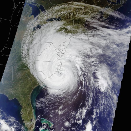
NASA's Terra satellite took this picture at 11:50 a.m. EDT on Sept. 18th just as heart of Isabel was making landfall. Red-, green- and blue-filtered images were combined to create a true-color view of the dangerous storm. A similar image was captured on Sept. 17th by NASA's Aqua satellite.
"The colors are natural," says Gary Jedlovec, a climate scientist at the National Space Science and Technology Center in Huntsville, AL. "This is what an astronaut would see looking down on the hurricane from orbit."
In fact, Terra and Aqua see much more than human eyes can. So do their sister satellites TRMM, Jason-1 and QuickScat--all members of NASA's Earth-observing fleet. Onboard instruments sense the temperature of the air, the distribution of moisture around the storm, the speed of its winds. They can even measure the heights of clouds.
"These data are invaluable to researchers who are trying to understand the inner workings of hurricanes," says Jedlovec. What causes a hurricane to start? Which way will it go? And how long will it last? "The more we learn from Terra and its cousins, the better we'll will be able to answer such questions."
Just ask anyone in North Carolina: they really want to know.


